High-Resolution Property Base Maps
Plan your land project with precision and confidence using our professional mapping services. Whether you’re designing a small farm, starting a permaculture project, or optimizing your property, our detailed base maps provide the critical insights you need.
Our Services
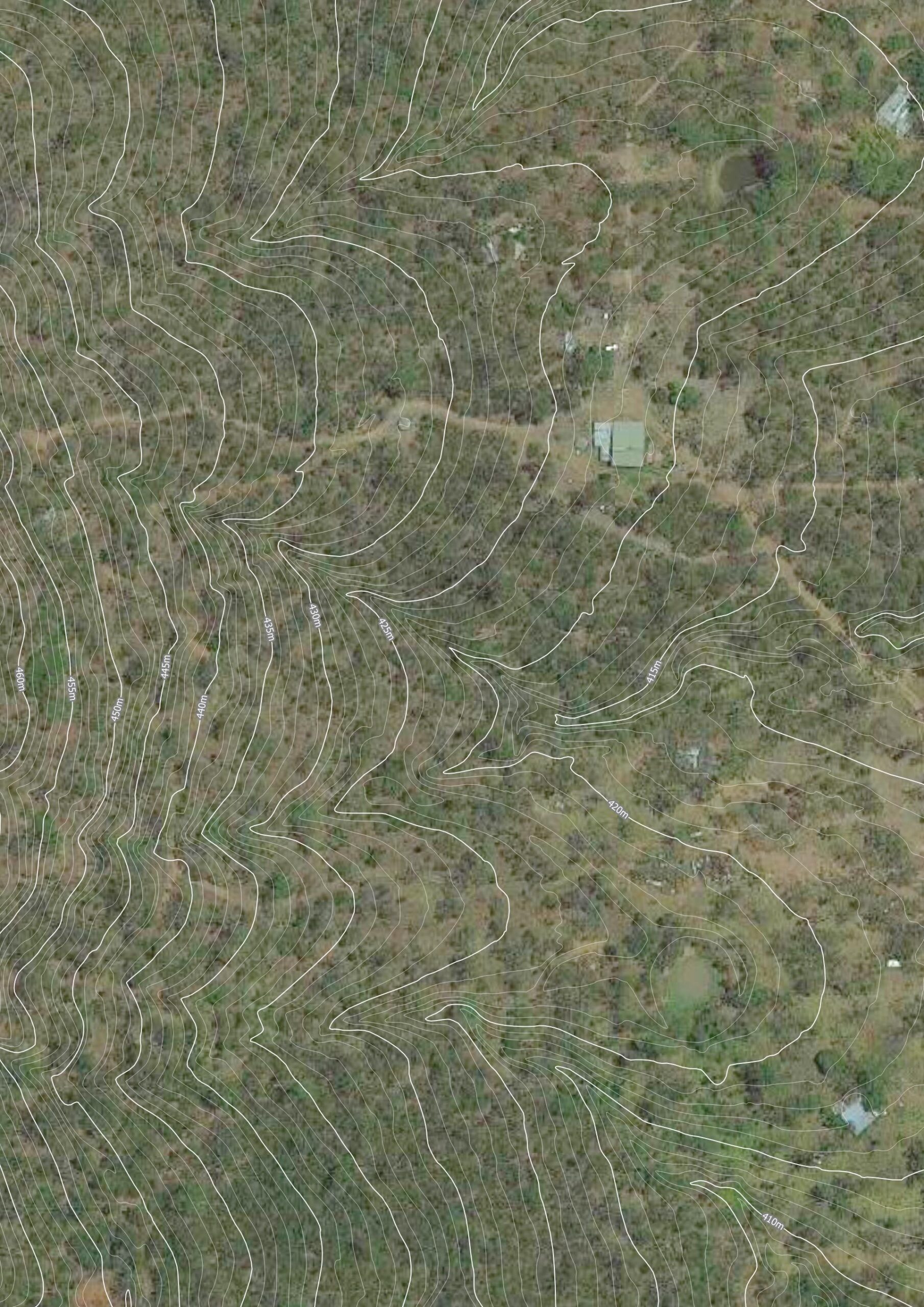
- Contour Mapping (50 cm – 1 m)
Visualize elevation changes and natural slopes for water management and land optimization.
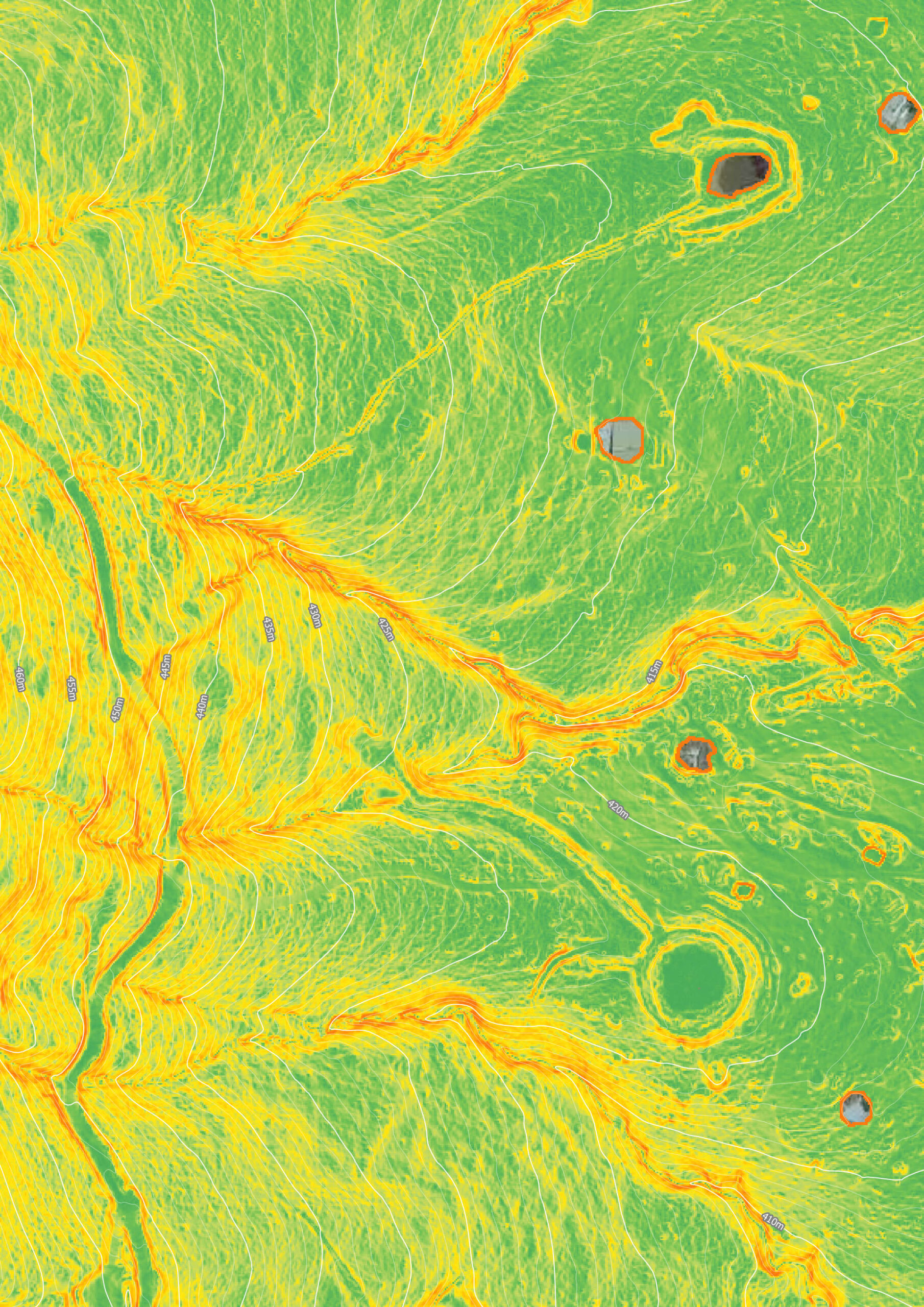
Free availability check required for contour data. - Slope Map
Visualise slope through colour and discover much about your slope than contours can provide. Red is steep and green is flat. - Property Boundaries
Cadastral boundaries to help you plan confidently and stay within your limits (accuracy within 10-15m). - Satellite Imagery (Google)
High-resolution visuals that reveal essential features of your landscape. - Optional Printing & Lamination
Field-ready, durable maps for hands-on use and long-lasting reference. - QGIS & Google Earth Pro Working Files Included
Get fully editable files, allowing you to customize and analyze your land data further.
Why Choose Our Base Maps?
- Optimize Your Land: Understand your property’s contours, boundaries, and features for effective planning.
- Informed Decisions: Plan confidently and avoid costly mistakes with precise data.
- National Availability: This service is available thoughout Australia
5 Benefits of Having a Detailed Contour Map
1️⃣ Better Water Management – Identify natural slopes to design efficient drainage, swales, and water catchment systems.
2️⃣ Improved Land Planning – Understand elevation changes to place infrastructure, roads, gardens, and buildings in the best locations.
3️⃣ Erosion Control – Prevent soil loss by working with the land’s natural contours to implement terracing and other stabilization techniques.
4️⃣ More Productive Growing Areas – Optimize planting zones based on water flow, soil retention, and microclimates created by land shape.
5️⃣ Saves Time & Money – Avoid costly mistakes by designing with precise land data instead of guesswork.
Cost: $250
Free with Our Consultation Service
When you book a consultation with us, high-resolution property contour base mapping is provided at no additional cost.
Need better imagery? Choose Drone Mapping
For anyone in Cairns and the Atherton Tablelands, we offer a premium drone mapping service. Capture ultra-clear aerial images of your property, perfect for detailed planning and analysis.
Get Started
Complete the form below to check contour data availability for your location and see how our base maps can transform your land project!


Contour data check:
Enter your details below and ill do a free contour property check to see if data is available in your area